What is Geocaching? How it Works and What You Find
/Geocaches are found all over the world and provide a free, fun family treasure hunt and hours of entertainment, but what is it, how does it work, and what do you find? This article tells you everything you need to know!
By Michelle Segrest - Navigate Travel Adventures
It’s all about the hunt.
We are not in search of the Holy Grail or some ridiculously expensive historic stash of golden artifacts. Geocaching is a virtual treasure hunt that meets somewhere at the corner of Indiana Jones and National Treasure. It is free entertainment and totally addictive!
People still ask me, “What did you find?” They always think we find diamonds or money or gold or something.
What geocachers find is much more valuable. An amazing view. A hidden landmark. Insight into a piece of history. An unexpected surprise that is not on the tourist map. The greatest treasures are found in the adventure, and the rewards are measured in the lasting memories.

I try to find at least one geocache everywhere I travel in the world and it always provides me with a great story to tell. It is a fun way to explore a new city and venture off the beaten tourist path. Geocaching always leads to something amazing that you would not have seen or experienced otherwise. Of course, it’s also great for just exploring your own neighborhood or hometown to find adventure and unexpected surprises you didn’t know were there!
No matter where you are, these little hidden boxes are lurking all around you. They are disguised as bison tubes, film cannisters, plastic boxes, ammo boxes and tiny magnets. Some look like tree bark, or mushrooms, or tree stumps, or fake rocks. Some are disguised as metal bolts or outlet covers…some even look like dog poo.

They are hidden in the trees—at the highest branches, in the roots and inside the knotholes. You can find them in bushes, in the pavement cracks, underneath window seals and park benches. Geocaches can be found at the bottom of the ocean or at the highest peak of a large mountain.
They can be found at every major landmark in the world. Some require special tools to retrieve, like a screwdriver or tweezers. There are increasing levels of difficulty and some require diving equipment, or a boat, or climbing tools. For mystery caches, you must solve some sort of puzzle or riddle. For multi-caches, the first find will leave a clue to the next one...and so on…and so on.
Some are super easy and great for kids. Others can take all day to hunt down and are specially designed and crafted for hardcore adventurers.
There are currently more than 6 million geocachers who right now are hunting for 2,687,072 active geocaches all over the globe. Each one offers a unique and special experience.
All you need to join the sport is a Geocaching account, a cell phone app with GPS or other GPS device, and an adventurous spirit.
The hiders of the geocache will leave clues and hints and provide the GPS coordinates to get you to “ground zero.” Then it’s up to you to find the cache, sign the log, and perhaps leave another clue to help the next treasure hunter.
I found my first geocache in July 2013 in Forest Park in Queens, N.Y. After a long hike through the woods, we found it at the end of a fallen tree, guarded by an active hornet nest. It was in the form of an old mason jar wrapped with camouflage duct tape. In it is the logbook where I first signed “TennisAces,” my geocaching handle.
It was just a jar containing a piece of paper with hundreds of names from around the world. And yet it’s difficult to describe the thrill of finding it. We found 10 other geocaches that day, and I was officially hooked!
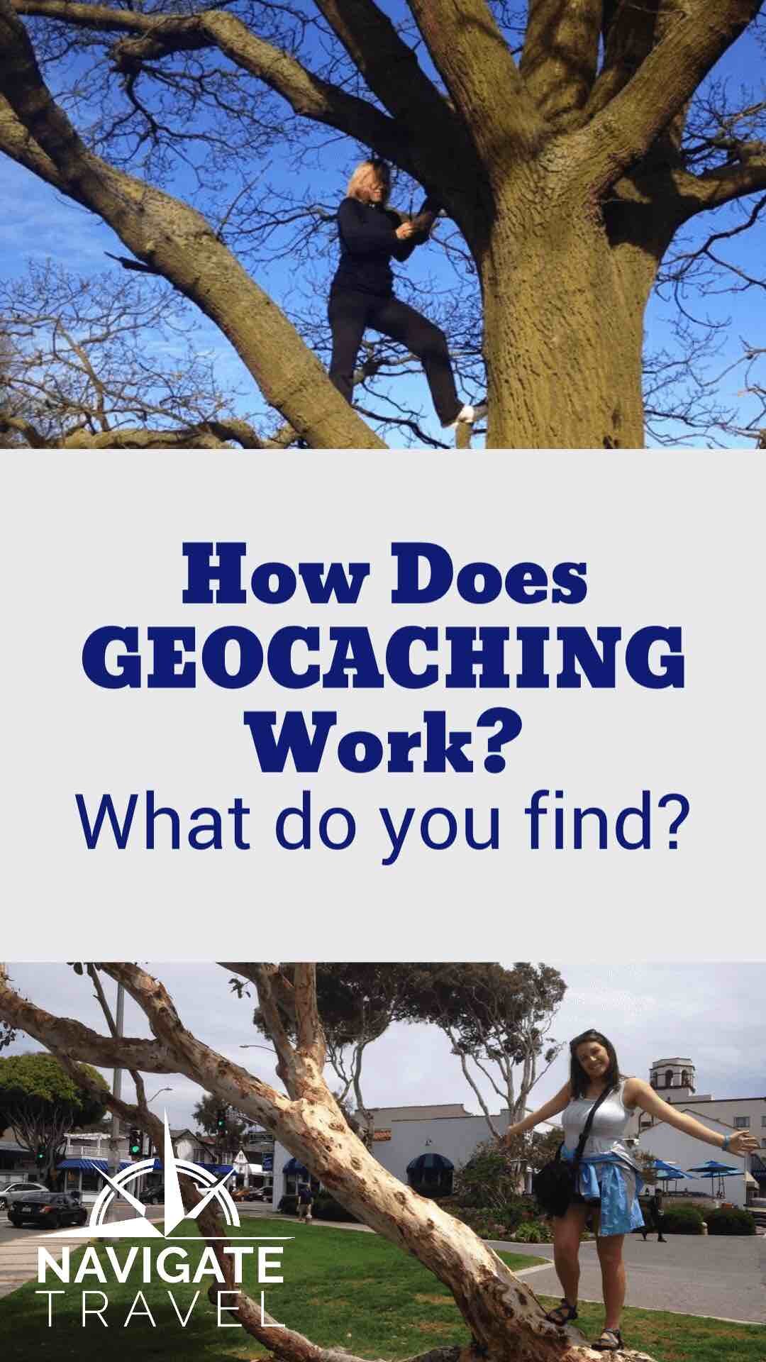
What do I need to go Geocaching? Top 5 Must-Have Tools for Geocachers
All you really need to enjoy geocaching is a cell phone with the official Geocaching App downloaded and an adventurous spirit. But these very cool tools will greatly enhance the geocaching experience.


The Garmin eTrex 10 Worldwide Handheld GPS Navigator — I love this because it usually works when your cell phone signal is low or nonexistent. It is rugged, waterproof, and preloaded with a worldwide basemap and 2.2-inch monochrome display. It provides fast positioning and a reliable signal. It uses two AA batteries that last up to 20 hours (works best with Polaroid AA batteries). With high and low elevation points you can store waypoints along a track to estimate time and distance between points.
Self-Inking Stamp — This allows you to sign geocaches without having to worry about having a pen.
UV Flashlight — Night geocaching is super fun so invest in a great UV flashlight so you can continue to hunt even when the sun goes down!
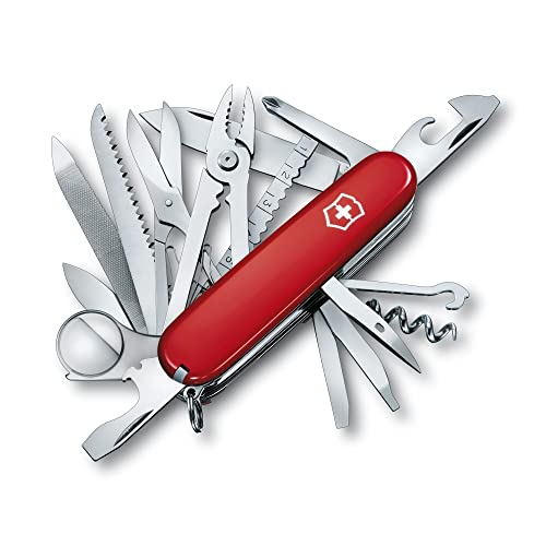
Multi-Tool Knife — Some geocaches require tools to get into small spaces or to unscrew a bolt or pick a lock to find the treasure inside. This tool will most definitely come in handy, I can assure you!
Sling Bag Shoulder Backpack — This is simply for convenience to keep all your other supplies handy for efficient treasure hunting.
Some of My Most Memorable Geocache Experiences
I travel often for business and for fun, and now geocaching is the first thing on my “to-do” list, especially when I visit a new place. I have found geocaches in more than 40 countries on six continents. I’ve also found many great ones less than 10 miles from my home in Alabama.
These are three of my favorite geocaching adventures! Please share some of your most incredible geocaching experiences.
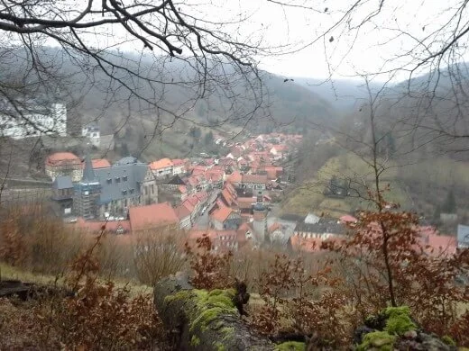
An Amazing View Discovered While Geocaching in Germany
Stolberg Blick | Stolberg, Sachsen-Anhalt, Germany
I had a full day to explore the quaint little town of Stolberg, Germany. I strolled briefly through the city center and then decided to search for a geocache. The GPS led me quickly to a back alley, something I would never have explored without the geocache compass leading the way.
Around a small bend there were stone steps that began an incline up a small mountain. I could see where this was leading and welcomed the exercise as well as the adventure. Up, up, up more and more stairs and steep hills I climbed.
At the top, I quickly spotted the glass tube hidden within a tree root. I was expecting to simply sign the log and then climb back down. Inside the cache was a note. “Turn around and take a photo of what you see.”
What an amazing surprise! From this spot, I could see a spectacular aerial view of the entire city of Stolberg. It was such a treat. There was a bench, so I sat and enjoyed the beautiful scenery and clear mountain air. It was incredible - something I would have missed had I not been chasing the geocache.

Searching for Geocaches and Camels in the Dubai Desert
Sharjah’s Jungle | Sharjah, United Arab Emirates
For business, I have visited the U.A.E. four times. Each time, I stayed inside the large metropolitan cities of Dubai and Abu Dhabi.
These cities are incredibly glitzy and are famous for superlatives. The biggest, the most expensive, the most ornate, the fastest, the tallest, the most everything is found there. I think of Dubai as the “Las Vegas of the Middle East” because it is very shiny and bedazzled and man-made. Yet the well-developed city sits in the middle of a gorgeous desert.
We had a free day, so my best friend and favorite co-cacher decided to take me away from all the sparkle and shine and show me what Dubai looked like 20 years ago. And I wanted to see wild camels roaming the desert.
We rented a car and headed out in search of a traditional cache hidden in a Ghaf tree “forest” in the Emirate of Sharjah.
Between Falaj al Moalla and the Rafee'a area there runs an underground water stream which can be recognized by the copses of Ghaf trees amidst the sand dunes. Many farms have been established in this broad swath of land.
We drove as close as we could, then parked and took off on foot through the beautiful soft sand dunes. Some say there are seven colors of sand in this part of the world, each attributed to one of the seven Emirates of the United Arab Emirates. But in fact, there are around 30 colors of sand throughout these deserts. It is truly breathtakingly natural beauty.
We hiked about a mile up and down the sand dunes, and then quickly found the cache.
It was a standard plastic lunchbox camouflaged by a brown sock. It was hidden in a particularly dense copse of trees.
We signed the log, replaced the cache and then enjoyed an amazing desert sunset that we will never forget. Again, an unexpected surprise.
We went back to the car, and I realized we had not yet found any camels. We drove a little and saw a “Camel Crossing” sign.
We looked to the right and there they were! A bonus treasure that we would never have found inside the glitzy city limits!

Standing in Two Countries at Once — A Geocaching Adventure at Zugspitze
Zugspitze Top of Germany | Bayern, Germany
At 2,962 meters above sea level, Zugspitze is the highest mountain in Germany, home to three glaciers and Germany’s highest ski resort. At the top is an impressive 360-degree panoramic view over 400 mountain peaks and four countries.
Zugspitze also marks the border between Germany and Austria. Before Europe united, you had to show your passport just to walk across the mountaintop. Today, lifts from both countries meet at the top.
I had always wanted to be in two places at once, and the hunt for this cool mystery cache put us directly on that spot. So we straddled the border, and I was able to check the seemingly impossible feat off my bucket list.
Restaurants, shops, and telescopes are available for tourists at the summit. The day we were there it was incredibly cold and foggy, so we didn’t get to see much of the view. But what we could see was fantastic!
There are two separate terraces—Bavarian and Tirolian—connected by a narrow walk, which was previously the border station. At one time, crossing was a big deal—you would get your passport stamped at the little blue house and shift your currency from shillings to marks. The border formalities are long gone, but the unique history remains.
The mountain railways of Bayerische Zugspitzbahn make it possible for anyone to enjoy the snow covered Zugspitze. You can take the cog wheel train from Zugspitze station Garmisch-Partenkirchen to the idyllic Lake Eibsee. The ascent with the Eibsee cable car offers spectacular views down to the lake, and more spectacular views can be seen from Zugspitze Peak.
Zugspitze is part of Wettersteingebirge, a small but important group of limestone mountains on the Austrian-German border, immediately South of the ski resort of Garmish-Partenkirchen.
The German side has the oldest building—the rustic, tin-and-wood weather tower, erected by the Deutscher Wetterdienst (German weather service) in 1900. The first mountaineers’ hut was built in 1897, but it didn’t last. The existing one dates from 1914. In 1985, observers clocked 200 mph winds up there.
The German side still features a golden cross that marks the country’s highest point. The historic original was destroyed by American soldiers who used it for target practice in the late 1940s. A modern replacement resides there today.
World War II left its mark on the summit as well. The Austrian side was higher until the Germans blew its top off during the war (to make a flak tower that targeted Allied airplanes).
Both Germany and Austria use this rocky pinnacle for communication purposes. A square box on the Tirolean Terrace provides data for Innsbruck Airport’s air traffic control system. A tower nearby is for the Katastrophenfunk (civil defense network), dating back to the Cold War.
You may also like these RELATED ARTICLES:


Post Script: Follow this link for a very cool account of the History of Geocaching,
If you like this article about Geocaching, please PIN IT!

This page contains affiliate links. If you click on the product links and make a purchase, it allows me to make a small commission at no extra cost to you! Thank you for your support and I hope you find value in this content!